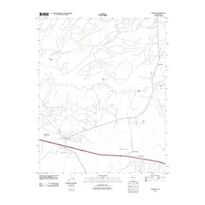
2010 Map of Thoreau
USGS Topo · Published 2010About this map
Thoreau serves as the primary hub of this 2010 landscape, situated at a junction of regional transit and commerce. The presence of the Thoreau Post Office and the Transwestern Pipeline Number 5 Airport highlights the settlement's role as a logistical center. To the east, the residential clusters of North Chaves and South Chaves line the corridor south of the interstate.
Find a feature on this map
22 named features on this map. Tap any name to fly to it.
Don’t see what you’re looking for? This feature index may not catch every label — zoom into the map to look around manually.
Map Details
Editions of this 2010 Thoreau Map
This is the sole edition of this map. No revisions or reprints were ever made.
Other maps of this area

1886 · Wingate
USGS Topo · 1:250,000

1892 · Wingate
USGS Topo · 1:250,000

1954 · Gallup
USGS Topo · 1:250,000

1958 · Gallup
USGS Topo · 1:250,000

1959 · Gallup
USGS Topo · 1:250,000

1961 · Cottonwood Canyon
USGS Topo · 1:24,000

1962 · Gallup
USGS Topo · 1:250,000

1962 · Continental Divide
USGS Topo · 1:24,000

1962 · Cottonwood Canyon
USGS Topo · 1:24,000
1963 · Hosta Butte
USGS Topo · 1:24,000