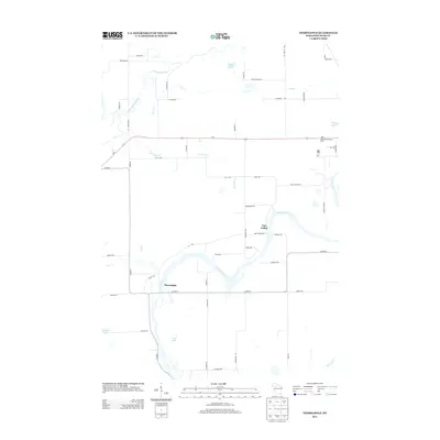
2013 Map of Thornapple
USGS Topo · Published 2013About this map
The Flambeau River defines the geography of this Rusk County landscape, winding past the settlements of Port Arthur and Thornapple. This 2013 survey records a region where water and timber legacies persist, anchored by the confluence of the Thornapple River and the Flambeau. The topography is marked by glacial remnants including Sunfish Lake, Long Lake, and Saxton Lake, alongside a dense network of tributaries like S Br Twin Cr and Deer Tail Cr. Human infrastructure is represented by the arterial Us-8 highway and several local corridors such as Old 14 Rd and Port Arthur Rd. A notable landmark, the Ladysmith Lookout Tower, stands near the eastern edge of the quadrangle, serving as a reminder of the area's forest management history and the surrounding timberland's susceptibility to fire.
Find a feature on this map
57 named features on this map. Tap any name to fly to it.
Don’t see what you’re looking for? This feature index may not catch every label — zoom into the map to look around manually.
Map Details
Editions of this 2013 Thornapple Map
This is the sole edition of this map. No revisions or reprints were ever made.
Other maps of this area

1944 · Exeland
USGS Topo · 1:48,000

1945 · Meteor
USGS Topo · 1:48,000

1947 · Exeland
USGS Topo · 1:48,000

1948 · Weyerhauser
USGS Topo · 1:48,000

1948 · Ladysmith
USGS Topo · 1:48,000

1949 · Meteor
USGS Topo · 1:48,000

1950 · Weyerhauser
USGS Topo · 1:48,000

1950 · Ladysmith
USGS Topo · 1:48,000

1953 · Rice Lake
USGS Topo · 1:250,000

1959 · Rice Lake
USGS Topo · 1:250,000