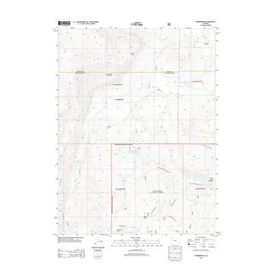
2013 Map of Thornburgh
USGS Topo · Published 2013About this map
Thornburgh sits at the heart of this landscape where the high plateau meets the drainage systems of Rio Blanco and Moffat Counties. The area is defined by a network of water management features and energy extraction, including the Thornburgh Gas Field and several irrigation works such as Wilson Ditch and the Martin Cr Ditch. To the south, the terrain rises sharply into the White River National Forest, culminating at heights like Uranium Peak and Sawmill Mtn. This intersection of industrial utility and protected wilderness is evident in the transition from gas wells and ranching reservoirs like Wyman Reservoir to the recreation-focused Milk Creekhorse Ridge Trail 1807. The presence of the D D and E Wise Reservoir and Aldrich Lakes suggests a complex history of water rights and land use essential for sustaining life in this high-altitude environment.
Find a feature on this map
35 named features on this map. Tap any name to fly to it.
Don’t see what you’re looking for? This feature index may not catch every label — zoom into the map to look around manually.
Map Details
Editions of this 2013 Thornburgh Map
This is the sole edition of this map. No revisions or reprints were ever made.
Other maps of this area

1910 · Danforth Hills
USGS Topo · 1:125,000

1912 · Meeker
USGS Topo · 1:62,500

1912 · Axial
USGS Topo · 1:62,500

1914 · Meeker
USGS Topo · 1:62,500

1914 · Axial
USGS Topo · 1:62,500

1915 · Monument Butte
USGS Topo · 1:62,500

1954 · Craig
USGS Topo · 1:250,000

1957 · Craig
USGS Topo · 1:250,000

1958 · Craig
USGS Topo · 1:250,000

1960 · Craig
USGS Topo · 1:250,000