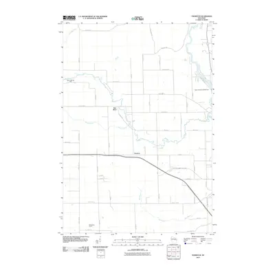
2010 Map of Thornton
USGS Topo · Published 2010About this map
The settlement of Thornton sits at the heart of this landscape, positioned where the Red River begins its winding southeastern course toward a confluence with the larger Wolf River. This geography is defined by its moving water, notably at Freeman Falls, Gilmer Falls, and Little Bull Falls, which signify the descent of the river system through central Wisconsin. Infrastructure for water management and aviation is evident through the Weed 2WP1507 Dam on the Red River and the Upper Shawano WP250 Dam to the east, while Dillenburgs Airport provides a grounded reference point for local aviation history. The grid of rural roads, such as County Hwy-A and Range Line Rd, connects the scattered farmsteads and woodlands between these waterways and smaller drainages like Kroenke Creek and Rose Brook.
Find a feature on this map
51 named features on this map. Tap any name to fly to it.
Don’t see what you’re looking for? This feature index may not catch every label — zoom into the map to look around manually.
Map Details
Editions of this 2010 Thornton Map
This is the sole edition of this map. No revisions or reprints were ever made.
Other maps of this area

1954 · Gresham
USGS Topo · 1:48,000

1954 · Shawano
USGS Topo · 1:48,000

1955 · Embarrass
USGS Topo · 1:48,000

1955 · Clintonville
USGS Topo · 1:48,000

1955 · Green Bay
USGS Topo · 1:250,000

1964 · Shawano
USGS Topo · 1:62,500

1964 · Gresham
USGS Topo · 1:62,500

1969 · Embarrass
USGS Topo · 1:24,000

1969 · Lunds
USGS Topo · 1:24,000

1970 · Clintonville North
USGS Topo · 1:24,000