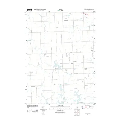
2011 Map of Thornville
USGS Topo · Published 2011About this map
The settlement of Thornville sits along the South Branch Flint River in this 2011 survey of Lapeer County, Michigan. The landscape is characterized by a dense concentration of burial grounds, making it a significant resource for genealogical research. Large cemetery sites include the South Dryden Pioneer Cemetery, North Dryden Cemetery, and the Saint John's Evangelical Lutheran Cemetery, which are scattered among the agricultural plots and small water bodies that define the region. To the east, the village of Dryden serves as a local hub, connected by a grid of rural routes such as Rochester Rd and Hollow Corners Rd. Natural features like Seven Ponds Lake and Whigville Lake suggest a glacial topography, while the D Bar A Scout Ranch occupies a notable portion of the western terrain. The map reflects a community where legacy and landscape are deeply intertwined through preserved memorial spaces and long-standing road corridors.
Find a feature on this map
89 named features on this map. Tap any name to fly to it.
Don’t see what you’re looking for? This feature index may not catch every label — zoom into the map to look around manually.
Map Details
Editions of this 2011 Thornville Map
This is the sole edition of this map. No revisions or reprints were ever made.
Other maps of this area

1943 · Lake Orion
USGS Topo · 1:24,000

1943 · Oxford
USGS Topo · 1:24,000

1943 · Metamora
USGS Topo · 1:24,000

1943 · Romeo
USGS Topo · 1:24,000

1945 · Almont
USGS Topo · 1:24,000

1945 · Thornville
USGS Topo · 1:24,000

1945 · Oxford
USGS Topo · 1:24,000

1945 · Romeo
USGS Topo · 1:24,000
1945 · Lake Orion
USGS Topo · 1:24,000

1946 · Metamora
USGS Topo · 1:24,000