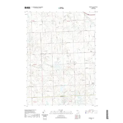
2019 Map of Thornville
USGS Topo · Published 2019About this map
Thornville and Dryden sit at the heart of this Lapeer County landscape, where the transition between rural townships and the northern reach of Oakland County is clearly defined. The terrain is marked by a dense concentration of cemeteries, such as Thornville Cem and the South Dryden Pioneer Cemetery, which speak to the deep-rooted settlement history of the region. The hydrology is dominated by the South Branch Flint River in the northwest and a network of glacial lakes to the south, including Hagemeister Lake, Loon Lake, and Wolf Lake.
Find a feature on this map
102 named features on this map. Tap any name to fly to it.
Don’t see what you’re looking for? This feature index may not catch every label — zoom into the map to look around manually.
Map Details
Editions of this 2019 Thornville Map
This is the sole edition of this map. No revisions or reprints were ever made.
Other maps of this area

1943 · Lake Orion
USGS Topo · 1:24,000

1943 · Oxford
USGS Topo · 1:24,000

1943 · Metamora
USGS Topo · 1:24,000

1943 · Romeo
USGS Topo · 1:24,000

1945 · Almont
USGS Topo · 1:24,000

1945 · Thornville
USGS Topo · 1:24,000

1945 · Oxford
USGS Topo · 1:24,000

1945 · Romeo
USGS Topo · 1:24,000
1945 · Lake Orion
USGS Topo · 1:24,000

1946 · Metamora
USGS Topo · 1:24,000