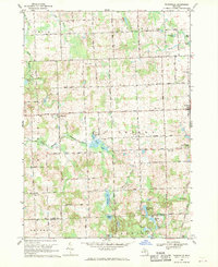
1968 Map of Thornville
USGS Topo · Published 1970About this map
Thornville and Dryden serve as the primary hubs of this landscape in the late 1960s, where agricultural land meets the headwaters of the South Branch Flint River. The area is notably dense with local burial grounds, ranging from the South Dryden Pioneer Cem to the Rock Valley Cem, providing a clear record of early settlement patterns for genealogists. The southern portion of the map transitions into a glacial lake district, featuring water bodies such as Seven Ponds Lake, Whigville Lake, and Hagemeister Lake. The Grand Trunk Western railroad corridor passes through the village of Dryden, while the General Squier Community Club and several gravel pits suggest a mix of community recreation and local industry. The intricate network of drains, including the Sanborn Drain and Weston Drain, illustrates the systematic water management required for this fertile Lapeer County terrain.
Find a feature on this map
47 named features on this map. Tap any name to fly to it.
Don’t see what you’re looking for? This feature index may not catch every label — zoom into the map to look around manually.
Map Details
Editions of this 1968 Thornville Map
This is the sole edition of this map. No revisions or reprints were ever made.
Other maps of this area

1943 · Lake Orion
USGS Topo · 1:24,000

1943 · Oxford
USGS Topo · 1:24,000

1943 · Metamora
USGS Topo · 1:24,000

1943 · Romeo
USGS Topo · 1:24,000

1945 · Almont
USGS Topo · 1:24,000

1945 · Thornville
USGS Topo · 1:24,000

1945 · Oxford
USGS Topo · 1:24,000

1945 · Romeo
USGS Topo · 1:24,000
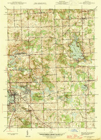
1945 · Lake Orion
USGS Topo · 1:24,000

1946 · Metamora
USGS Topo · 1:24,000