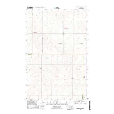
2017 Map of Thornwood Ranch
USGS Topo · Published 2017About this map
Thornwood Ranch anchors the southern half of this landscape where the boundaries of Sheridan County and Roosevelt County meet. The terrain is defined by the winding course of Wolf Cr in the north and the significant drainage of Burshia Coulee to the west. This area reflects a traditional Montana ranching layout, where wide-reaching section lines are occasionally interrupted by natural topographic breaks.
Find a feature on this map
16 named features on this map. Tap any name to fly to it.
Don’t see what you’re looking for? This feature index may not catch every label — zoom into the map to look around manually.
Map Details
Editions of this 2017 Thornwood Ranch Map
This is the sole edition of this map. No revisions or reprints were ever made.
Other maps of this area

1909 · Smoke Creek
USGS Topo · 1:62,500

1912 · Smoke Creek
USGS Topo · 1:62,500

1914 · Homestead
USGS Topo · 1:62,500

1954 · Wolf Point
USGS Topo · 1:250,000

1958 · Wolf Point
USGS Topo · 1:250,000

1982 · Culbertson
USGS Topo · 1:100,000
1983 · Homestead NW
USGS Topo · 1:24,000

1983 · Kisler Butte
USGS Topo · 1:24,000
1983 · Flagstaff Hill
USGS Topo · 1:24,000
1983 · Smoke Creek NE
USGS Topo · 1:24,000