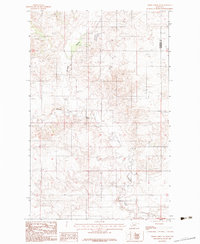
1983 Map of Smoke Creek NE
USGS Topo · Published 1983About this map
Smoke Creek meanders through the central and southern reaches of this landscape within the Fort Peck Indian Reservation. The drainage patterns across this part of Roosevelt County are defined by intermittent watercourses and the prominent Burshia Coulee, which carves through the northwestern quadrant of the sheet. Based on field work conducted in the late 1970s, this record illustrates a predominantly rural and open terrain, largely devoid of dense settlement or industrial development. The northeastern corner of the map marks a jurisdictional boundary between Roosevelt Co and Sheridan Co. For those studying the geography of northeastern Montana, the map offers a precise look at the topographical relief and elevation changes that dictate the flow of seasonal water towards the larger Missouri River watershed.
Find a feature on this map
3 named features on this map. Tap any name to fly to it.
Don’t see what you’re looking for? This feature index may not catch every label — zoom into the map to look around manually.
Map Details
Editions of this 1983 Smoke Creek NE Map
This is the sole edition of this map. No revisions or reprints were ever made.
Other maps of this area

1909 · Smoke Creek
USGS Topo · 1:62,500

1912 · Smoke Creek
USGS Topo · 1:62,500

1914 · Homestead
USGS Topo · 1:62,500

1947 · Rocky Point
USGS Topo · 1:24,000

1948 · Rocky Point
USGS Topo · 1:24,000

1950 · Coyote Coulee
USGS Topo · 1:24,000

1954 · Wolf Point
USGS Topo · 1:250,000

1958 · Wolf Point
USGS Topo · 1:250,000

1982 · Culbertson
USGS Topo · 1:100,000
1983 · Homestead NW
USGS Topo · 1:24,000