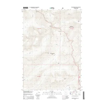
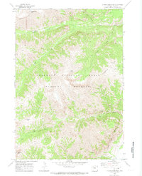
2015 Map of Thorofare Buttes
USGS Topo · Published 2015About this map
Ishawooa Cone and the surrounding high-altitude terrain of the Absaroka Range dominate this study of the Wyoming wilderness. The map documents the boundary between the Shoshone National Forest and Teton National Forest, illustrating a landscape defined by dramatic elevation changes and a network of drainages. Key watercourses such as Ishawooa Cr and Open Creek carve through the mountain passes. The presence of Petrified Ridge and Wapiti Ridge suggests a complex geological character, while named crossings like Ishawooa Pass and Rampart Pass indicate established routes through the peaks. This 2015 survey provides a modern topographical record of the Thorofare Buttes region, where the remote geography remains largely untouched by development, preserved within the national forest system.
Find a feature on this map
31 named features on this map. Tap any name to fly to it.
Don’t see what you’re looking for? This feature index may not catch every label — zoom into the map to look around manually.
Map Details
Editions of this 2015 Thorofare Buttes Map
This is the sole edition of this map. No revisions or reprints were ever made.
Other maps of this area

1893 · Ishawooa
USGS Topo · 1:125,000

1895 · Ishawooa
USGS Topo · 1:125,000

1899 · Ishawooa
USGS Topo · 1:125,000

1955 · Cody
USGS Topo · 1:250,000

1958 · Cody
USGS Topo · 1:250,000

1962 · Cody
USGS Topo · 1:250,000
1970 · Sheep Mesa
USGS Topo · 1:24,000
1970 · Fall Creek
USGS Topo · 1:24,000
1970 · Yellow Mountain
USGS Topo · 1:24,000
1970 · Clouds Home Peak
USGS Topo · 1:24,000