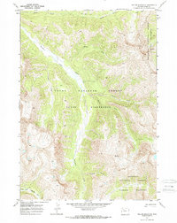
1970 Map of Yellow Mountain
USGS Topo · Published 1973About this map
The Yellow Mountain area within Park County is defined by the complex confluence of alpine waterways and protected forest lands as they appeared in 1970. This landscape is shaped by the wide valley of Thorofare Creek, which collects numerous tributaries including Dell Creek, Woody Creek, and the Burner Fork. The presence of the Thorofare Trail (Pack) indicates the area's primary mode of access through the Teton Wilderness and Washakie Wilderness. These primitive routes and the absence of roads underscore the remote character of this high-elevation region during the late 20th century.
Find a feature on this map
15 named features on this map. Tap any name to fly to it.
Don’t see what you’re looking for? This feature index may not catch every label — zoom into the map to look around manually.
Map Details
Editions of this 1970 Yellow Mountain Map
2 editions found
Other maps of this area

1893 · Ishawooa
USGS Topo · 1:125,000

1895 · Ishawooa
USGS Topo · 1:125,000

1899 · Ishawooa
USGS Topo · 1:125,000

1905 · Younts Peak
USGS Topo · 1:125,000

1907 · Younts Peak
USGS Topo · 1:125,000

1955 · Cody
USGS Topo · 1:250,000

1955 · Thermopolis
USGS Topo · 1:250,000

1958 · Cody
USGS Topo · 1:250,000

1958 · Thermopolis
USGS Topo · 1:250,000

1962 · Thermopolis
USGS Topo · 1:250,000