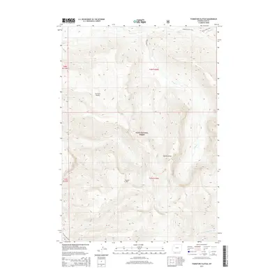
2015 Map of Thorofare Plateau
USGS Topo · Published 2015About this map
Teton National Forest dominates this high-elevation landscape, where the Absaroka Range provides a dramatic backdrop for the sprawling Thorofare Plateau. This 2015 U.S. Geological Survey representation documents a region defined by its hydrography and lack of vehicle access, centered on the N Fork Yellowstone River and its various tributaries including Thorofare Cr and Castle Cr. The absence of roads is notable, with the transportation network consisting entirely of established wilderness paths such as the Thorofare River Trail and Yellowstone Trails. Topographical landmarks like Thunder Mtn rise sharply from the drainage basins of Hidden Cr, illustrating the extreme relief typical of the Wyoming backcountry during the early 21st century.
Find a feature on this map
15 named features on this map. Tap any name to fly to it.
Don’t see what you’re looking for? This feature index may not catch every label — zoom into the map to look around manually.
Map Details
Editions of this 2015 Thorofare Plateau Map
This is the sole edition of this map. No revisions or reprints were ever made.
Other maps of this area

1885 · Lake
USGS Topo · 1:125,000

1893 · Ishawooa
USGS Topo · 1:125,000

1895 · Ishawooa
USGS Topo · 1:125,000

1895 · Lake
USGS Topo · 1:125,000

1896 · Lake
USGS Topo · 1:125,000

1899 · Ishawooa
USGS Topo · 1:125,000

1901 · Lake
USGS Topo · 1:125,000

1902 · Mt Leidy
USGS Topo · 1:125,000

1905 · Younts Peak
USGS Topo · 1:125,000

1906 · Lake
USGS Topo · 1:125,000