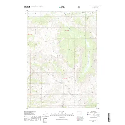
2017 Map of Thorofare Plateau
USGS Topo · Published 2017About this map
The high-altitude drainage of the N Fork Yellowstone River defines this portion of the Absaroka Range within the Teton National Forest. Centered on the sprawling Thorofare Plateau, the landscape is a complex network of glacial-cut valleys and peaks, including the prominent Thunder Mtn. These remote highlands serve as a critical watershed, where Thorofare Cr, Hidden Creek, and Castle Cr gather before descending toward the river valley. Human passage through this wilderness is restricted to historical pathways like the Thorofare River Trail, the Butte Creek Trail, and the Yellowstone Trail. The absence of roads or permanent settlements underscores the area's role as one of the most secluded regions in the continental United States, where the topography itself dictates the routes of travel and water flow.
Find a feature on this map
18 named features on this map. Tap any name to fly to it.
Don’t see what you’re looking for? This feature index may not catch every label — zoom into the map to look around manually.
Map Details
Editions of this 2017 Thorofare Plateau Map
This is the sole edition of this map. No revisions or reprints were ever made.
Other maps of this area

1885 · Lake
USGS Topo · 1:125,000

1893 · Ishawooa
USGS Topo · 1:125,000

1895 · Ishawooa
USGS Topo · 1:125,000

1895 · Lake
USGS Topo · 1:125,000

1896 · Lake
USGS Topo · 1:125,000

1899 · Ishawooa
USGS Topo · 1:125,000

1901 · Lake
USGS Topo · 1:125,000

1902 · Mt Leidy
USGS Topo · 1:125,000

1905 · Younts Peak
USGS Topo · 1:125,000

1906 · Lake
USGS Topo · 1:125,000