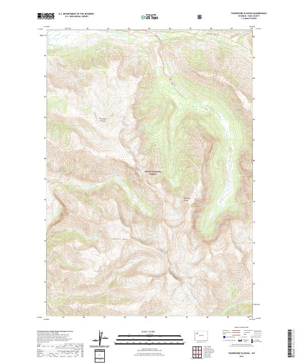
2021 Map of Thorofare Plateau
USGS Topo · Published 2021About this map
Teton National Forest encompasses this high-elevation backcountry in Park County, where the sprawling Thorofare Plateau meets the peaks of the Absaroka Range. The landscape is defined by its drainage systems, with the N Fork Yellowstone River cutting through the southern reaches while Thorofare Cr and its tributaries, including Butte Cr and Hidden Cr, carve deep basins to the north. This 2021 survey highlights a network of established wilderness paths such as the Thorofare River Trl and the Yellowstone River Trl, which provide the primary means of navigation through the steep terrain near Thunder Mtn. The map illustrates a remote environment where the natural contours of the land and the paths of the waterways dictate human movement, far from the infrastructure of developed settlements.
Find a feature on this map
17 named features on this map. Tap any name to fly to it.
Don’t see what you’re looking for? This feature index may not catch every label — zoom into the map to look around manually.
Map Details
Editions of this 2021 Thorofare Plateau Map
This is the sole edition of this map. No revisions or reprints were ever made.
Other maps of this area

1885 · Lake
USGS Topo · 1:125,000

1893 · Ishawooa
USGS Topo · 1:125,000

1895 · Ishawooa
USGS Topo · 1:125,000

1895 · Lake
USGS Topo · 1:125,000

1896 · Lake
USGS Topo · 1:125,000

1899 · Ishawooa
USGS Topo · 1:125,000

1901 · Lake
USGS Topo · 1:125,000

1902 · Mt Leidy
USGS Topo · 1:125,000

1905 · Younts Peak
USGS Topo · 1:125,000

1906 · Lake
USGS Topo · 1:125,000