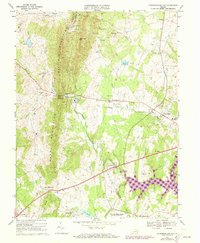
1966 Map of Thoroughfare Gap
USGS Topo · Published 1973About this map
Bull Run Mountains and Pond Mountains dominate this landscape, split by the narrow passage of Thoroughfare Gap. This natural corridor serves as the primary route for both the Southern railroad and Broad Run, creating a concentrated zone of transit and industry as evidenced by the historic Beverley Mill and numerous quarries along the ridge. To the east, the terrain transitions into the Piedmont lowlands, where established communities like Haymarket, Buckland, and Greenwich are connected by a growing network of roads and the visible presence of a major Pipeline. The southern portion of the map is defined by the Vint Hill Farms Station Military Reservation, while the surrounding countryside is dotted with community centers such as the Antioch-McCrae Sch and Oakrum Ch, reflecting the rural social fabric of mid-20th-century Prince William and Fauquier Counties.
Find a feature on this map
53 named features on this map. Tap any name to fly to it.
Don’t see what you’re looking for? This feature index may not catch every label — zoom into the map to look around manually.
Map Details
Editions of this 1966 Thoroughfare Gap Map
3 editions found

Other maps of this area

1894 · Warrenton
USGS Topo · 1:125,000

1894 · Warrenton
USGS Topo · 1:62,500

1927 · Remington
USGS Topo · 1:48,000

1930 · Warrenton
USGS Topo · 1:62,500

1933 · Middleburg
USGS Topo · 1:62,500

1943 · Catlett
USGS Topo · 1:62,500

1943 · Arcola
USGS Topo · 1:24,000

1943 · Thorofare Gap
USGS Topo · 1:24,000

1943 · Marshall
USGS Topo · 1:24,000

1943 · Rectortown
USGS Topo · 1:24,000