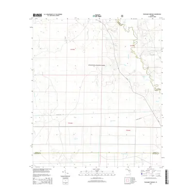
2015 Map of Thousand Yard Bay
USGS Topo · Published 2015About this map
The Apalachicola National Forest dominates this section of the Florida panhandle, where the land is defined by a dense network of slow-moving water and expansive wetlands. The eastern boundary is shaped by the winding Ochlockonee River, which creates a complex system of offshoots including Swift Slough and the Vause Br Ochlockonee River. This low-lying terrain transitions into the namesake Thousand Yard Bay, a large wetland feature south of National Forest Rd.
Find a feature on this map
26 named features on this map. Tap any name to fly to it.
Don’t see what you’re looking for? This feature index may not catch every label — zoom into the map to look around manually.
Map Details
Editions of this 2015 Thousand Yard Bay Map
This is the sole edition of this map. No revisions or reprints were ever made.
Other maps of this area

1944 · Pickett Bay
USGS Topo · 1:31,680

1944 · Queens Bay
USGS Topo · 1:24,000

1945 · Thousand Yard Bay
USGS Topo · 1:31,680

1945 · Smith Creek
USGS Topo · 1:31,680

1945 · Bradwell Bay
USGS Topo · 1:31,680

1945 · Tates Hell Swamp
USGS Topo · 1:31,680

1945 · Mc Intyre
USGS Topo · 1:31,680

1945 · Pickett Bay
USGS Topo · 1:31,680

1945 · Sanborn
USGS Topo · 1:31,680

1946 · Queens Bay
USGS Topo · 1:31,680