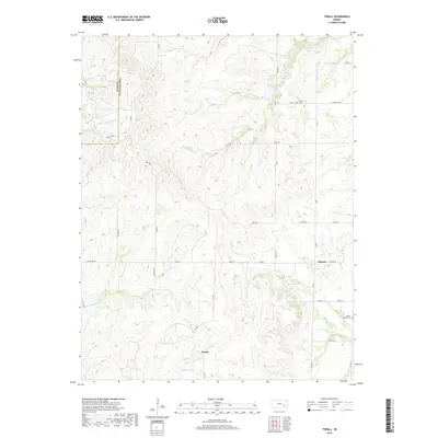
2018 Map of Thrall
USGS Topo · Published 2018About this map
Thrall and Burkett are the primary focal points of this portion of Greenwood County, where the eastern Kansas prairie is carved by a dense network of tributaries. The headwaters of the N Br Verdigris River and Bernard Br define the northern landscape, while southern drainage feeds into Sinclair Lake via Swing Cr. This topography, characterized by undulating ridges and narrow creek valleys, dictated the local road network that follows section lines where possible, such as Madison Rd and Teterhill Rd. Genealogy interests are served by the location of Andrew Cem in the north and Prairie Chapel Cem near the eastern boundary, providing specific points of reference for early settler families. The map illustrates a rural landscape where small community centers like Burkett persisted alongside established water sources like Indian Cr and Slate Cr.
Find a feature on this map
30 named features on this map. Tap any name to fly to it.
Don’t see what you’re looking for? This feature index may not catch every label — zoom into the map to look around manually.
Map Details
Editions of this 2018 Thrall Map
This is the sole edition of this map. No revisions or reprints were ever made.
Other maps of this area

1885 · Eureka
USGS Topo · 1:125,000

1888 · Emporia
USGS Topo · 1:125,000

1888 · Eureka
USGS Topo · 1:125,000

1894 · Emporia
USGS Topo · 1:125,000

1894 · Eureka
USGS Topo · 1:125,000

1955 · Wichita
USGS Topo · 1:250,000

1955 · Hutchinson
USGS Topo · 1:250,000

1958 · Wichita
USGS Topo · 1:250,000

1959 · Hutchinson
USGS Topo · 1:250,000

1967 · Madison SW
USGS Topo · 1:24,000