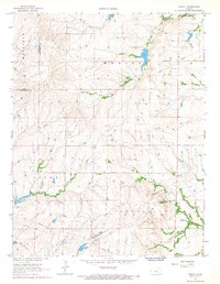
1967 Map of Thrall
USGS Topo · Published 1968About this map
The Thrall Aagard Oil Field and surrounding energy deposits define the economic landscape of Greenwood County during the late 1960s. This survey records the extensive infrastructure of the regional petroleum industry, from the scattered oil wells in the Teter Oil Field to the Pumping Station near the settlement of Thrall. The terrain is characterized by the winding paths of Slate Creek and Indian Creek, which cut through the townships of Madison, Salem, and Janesville.
Find a feature on this map
23 named features on this map. Tap any name to fly to it.
Don’t see what you’re looking for? This feature index may not catch every label — zoom into the map to look around manually.
Map Details
Editions of this 1967 Thrall Map
This is the sole edition of this map. No revisions or reprints were ever made.
Other maps of this area

1885 · Eureka
USGS Topo · 1:125,000

1888 · Emporia
USGS Topo · 1:125,000

1888 · Eureka
USGS Topo · 1:125,000

1894 · Emporia
USGS Topo · 1:125,000

1894 · Eureka
USGS Topo · 1:125,000

1955 · Wichita
USGS Topo · 1:250,000

1955 · Hutchinson
USGS Topo · 1:250,000

1958 · Wichita
USGS Topo · 1:250,000

1959 · Hutchinson
USGS Topo · 1:250,000

1967 · Madison SW
USGS Topo · 1:24,000