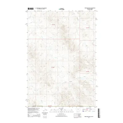
2014 Map of Three Bar Ranch
USGS Topo · Published 2014About this map
Three Bar Ranch serves as a central landmark within this high-plains landscape along the border of Wyoming and Montana. The geography is defined by an intricate drainage system where the N Fork Three Bar Cr and S Fork Three Bar Cr converge, eventually flowing as Three Bar Cr toward the northwest. This network of seasonal waterways, including Buffalo Cr and Lock Cr, illustrates the importance of water management for cattle ranching in the Powder River Basin. Human presence is concentrated around the ranch and the gravel pathways of 3 Bar Rd and Bay Horse Rd, which follow the natural contours of the terrain. The map captures a moment in the early 21st century when these remote ranching operations remained the primary feature of the region's land use and infrastructure.
Find a feature on this map
16 named features on this map. Tap any name to fly to it.
Don’t see what you’re looking for? This feature index may not catch every label — zoom into the map to look around manually.
Map Details
Editions of this 2014 Three Bar Ranch Map
This is the sole edition of this map. No revisions or reprints were ever made.
Other maps of this area

1954 · Ekalaka
USGS Topo · 1:250,000

1954 · Gillette
USGS Topo · 1:250,000

1955 · Gillette
USGS Topo · 1:250,000

1956 · Ekalaka
USGS Topo · 1:250,000

1958 · Gillette
USGS Topo · 1:250,000

1958 · Ekalaka
USGS Topo · 1:250,000

1962 · Gillette
USGS Topo · 1:250,000

1965 · Ekalaka
USGS Topo · 1:250,000

1970 · Moorhead
USGS Topo · 1:24,000

1970 · Baldy Peak
USGS Topo · 1:24,000