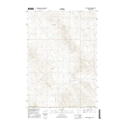
2017 Map of Three Bar Ranch
USGS Topo · Published 2017About this map
Three Bar Ranch serves as a primary reference point in this corner of the Powder River Basin, situated near the headwaters of several drainages along the Montana-Wyoming border. The landscape is defined by the dendritic patterns of Three Bar Cr, including its North and South forks, which carve through the high plains. The transition between Powder River County, Montana, and Campbell County, Wyoming, is marked by a network of rural routes such as Three Bar Rd and Bay Horse Rd. This survey documents the spatial organization of range lands and the strategic placement of ranching infrastructure relative to water sources like Buffalo Cr and Bay Horse Cr during the late 2010s.
Find a feature on this map
14 named features on this map. Tap any name to fly to it.
Don’t see what you’re looking for? This feature index may not catch every label — zoom into the map to look around manually.
Map Details
Editions of this 2017 Three Bar Ranch Map
This is the sole edition of this map. No revisions or reprints were ever made.
Other maps of this area

1954 · Ekalaka
USGS Topo · 1:250,000

1954 · Gillette
USGS Topo · 1:250,000

1955 · Gillette
USGS Topo · 1:250,000

1956 · Ekalaka
USGS Topo · 1:250,000

1958 · Gillette
USGS Topo · 1:250,000

1958 · Ekalaka
USGS Topo · 1:250,000

1962 · Gillette
USGS Topo · 1:250,000

1965 · Ekalaka
USGS Topo · 1:250,000

1970 · Moorhead
USGS Topo · 1:24,000

1970 · Baldy Peak
USGS Topo · 1:24,000