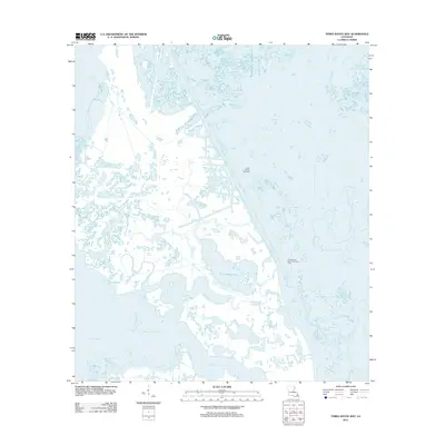
2012 Map of Three Bayou Bay
USGS Topo · Published 2012About this map
Lafitte Oil and Gas Field and the Three Bayou Bay Oil and Gas Field dominate the landscape of this Jefferson Parish coastal region, illustrating the heavy industrial footprint of energy extraction within the Louisiana wetlands. The map reveals an intricate network of dredging and canals required to navigate and service these fields, slicing through the natural marsh and swamp terrain.
Find a feature on this map
10 named features on this map. Tap any name to fly to it.
Don’t see what you’re looking for? This feature index may not catch every label — zoom into the map to look around manually.
Map Details
Editions of this 2012 Three Bayou Bay Map
This is the sole edition of this map. No revisions or reprints were ever made.
Other maps of this area

1891 · Pointe a La Hache
USGS Topo · 1:62,500

1892 · Barataria
USGS Topo · 1:62,500

1892 · Creole
USGS Topo · 1:62,500

1892 · Pointe a La Hache
USGS Topo · 1:62,500

1893 · Fort Livingston
USGS Topo · 1:62,500

1935 · Wilkinson Bay
USGS Topo · 1:31,680

1939 · Pointe a La Hache
USGS Topo · 1:62,500

1941 · Barataria
USGS Topo · 1:62,500

1944 · Barataria
USGS Topo · 1:62,500
1944 · Pointe a La Hache
USGS Topo · 1:62,500