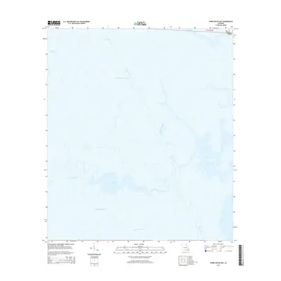
2015 Map of Three Bayou Bay
USGS Topo · Published 2015About this map
Barataria Bay Waterway cuts a straight, industrial path through the intricate coastal wetlands of Jefferson Parish, reflecting the modern navigational engineering of south Louisiana. This maritime landscape is defined by the convergence of natural tidal channels and man-made passages like Dupre Cut, which bypasses the winding historical reaches of Bayou Cutler. The survey illustrates a delicate environment of brackish lakes and bayous, including Turtle Bay and Long Bay, where land and water dissolve into one another. Farther south, Bayou Saint Denis provides a broad outlet into the larger bay system, while smaller arteries such as Bayou Maurice and Three Bayou Bay weave through the marsh. This 2015 record documents the specific configuration of these sensitive coastal features before further sediment shifts and coastal changes alter the Louisiana shoreline.
Find a feature on this map
12 named features on this map. Tap any name to fly to it.
Don’t see what you’re looking for? This feature index may not catch every label — zoom into the map to look around manually.
Map Details
Editions of this 2015 Three Bayou Bay Map
This is the sole edition of this map. No revisions or reprints were ever made.
Other maps of this area

1891 · Pointe a La Hache
USGS Topo · 1:62,500

1892 · Barataria
USGS Topo · 1:62,500

1892 · Creole
USGS Topo · 1:62,500

1892 · Pointe a La Hache
USGS Topo · 1:62,500

1893 · Fort Livingston
USGS Topo · 1:62,500

1935 · Wilkinson Bay
USGS Topo · 1:31,680

1939 · Pointe a La Hache
USGS Topo · 1:62,500

1941 · Barataria
USGS Topo · 1:62,500

1944 · Barataria
USGS Topo · 1:62,500
1944 · Pointe a La Hache
USGS Topo · 1:62,500