
1973 Map of Three Bluff Draw NE
USGS Topo · Published 1976About this map
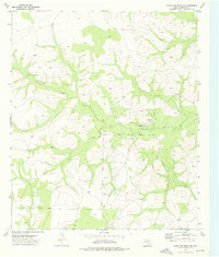
The rolling plains of West Texas meet at a three-county junction in this early 1970s survey. The borderlines of Glasscock, Reagan, and Sterling counties intersect near a high point marked BM 2674. The landscape is defined by the ephemeral drainages of Sterling Creek and Indian Creek, where the natural topography is punctuated by the infrastructure of the energy and construction sectors. Evidence of resource extraction is scattered across the terrain, from an Oil Well and a prominent Pipeline in the southwest to several Gravel Pits in the northeast. The location of Barton provides a specific point of reference for local historians or genealogists tracking family land and early ranching footprints in this sparsely settled region of the Permian Basin.
Find a feature on this map
13 named features on this map. Tap any name to fly to it.
Don’t see what you’re looking for? This feature index may not catch every label — zoom into the map to look around manually.
Map Details
Editions of this 1973 Three Bluff Draw NE Map
This is the sole edition of this map. No revisions or reprints were ever made.
Other maps of this area

1954 · San Angelo
USGS Topo · 1:250,000

1958 · San Angelo
USGS Topo · 1:250,000

1963 · Glass Ranch
USGS Topo · 1:24,000

1963 · Currie Reservoir
USGS Topo · 1:24,000

1963 · Garden City
USGS Topo · 1:24,000

1965 · San Angelo
USGS Topo · 1:250,000

1973 · Hay Hollow
USGS Topo · 1:24,000

1973 · Three Bluff Draw
USGS Topo · 1:24,000
1973 · Coon Dive Draw NW
USGS Topo · 1:24,000
1973 · Three Bluff Draw NW
USGS Topo · 1:24,000