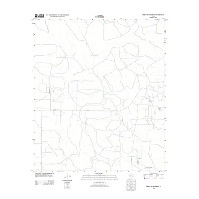
2012 Map of Three Bluff Draw
USGS Topo · Published 2012About this map
Lone Joe Ranch and the eponymous Three Bluff Draw anchor this West Texas landscape in Tom Green County. The area is defined by a dendritic network of intermittent watercourses including Corral Cr and Indian Cr, which eventually drain toward the Middle Concho River in the southeast. This terrain is characteristic of the Edwards Plateau's ranching and energy-producing country, where large land holdings are bisected by straight-line roads like Holt Ranch Rd and Arroyo Rd. The presence of the Cope Oil Field near Hackberry Draw illustrates the region's reliance on mineral resources alongside traditional pastoral use. Family-named infrastructure, such as Momma Pfluger Rd and Lone Joe Rd, provides a trace of local land ownership and lineage in a sparsely populated section of the Concho Valley.
Find a feature on this map
15 named features on this map. Tap any name to fly to it.
Don’t see what you’re looking for? This feature index may not catch every label — zoom into the map to look around manually.
Map Details
Editions of this 2012 Three Bluff Draw Map
This is the sole edition of this map. No revisions or reprints were ever made.
Other maps of this area

1921 · Ketchum Mountain
USGS Topo · 1:62,500

1923 · Ketchum Mountain
USGS Topo · 1:62,500

1954 · San Angelo
USGS Topo · 1:250,000

1958 · San Angelo
USGS Topo · 1:250,000

1965 · San Angelo
USGS Topo · 1:250,000

1970 · South Mustang Draw NE
USGS Topo · 1:24,000

1970 · Moore Hill
USGS Topo · 1:24,000

1973 · Hay Hollow
USGS Topo · 1:24,000

1973 · Three Bluff Draw
USGS Topo · 1:24,000

1973 · Three Bluff Draw NE
USGS Topo · 1:24,000