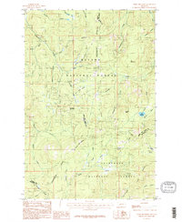
1985 Map of Three Brothers
USGS Topo · Published 1986About this map
The Continental Divide snakes through this high-elevation terrain where Powell, Lewis and Clark, and Jefferson Counties meet. This 1985 survey captures a landscape dominated by the protected acreage of the Helena National Forest and Deerlodge National Forest. The region’s extractive history is evident in the numerous Mine Shaft and prospect locations scattered across the slopes of Jericho Mountain and O'Keefe Mountain. Water management for the surrounding valleys is anchored by the Scott Reservoir in the eastern portion of the quadrangle. Drainage patterns are complex, with headwaters such as Minnehaha Creek and Tenmile Creek carving deep gulches like Flume Gulch and Telegraph Gulch. Lower-lying features like Sure Thing Swamps and Cataract Meadows provide a distinct contrast to the surrounding peaks, including Luttrell Peak and the namesake Three Brothers Creek drainage.
Find a feature on this map
41 named features on this map. Tap any name to fly to it.
Don’t see what you’re looking for? This feature index may not catch every label — zoom into the map to look around manually.
Map Details
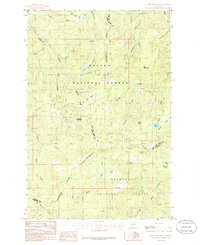
Editions of this 1985 Three Brothers Map
2 editions found
Other maps of this area

1889 · Helena
USGS Topo · 1:250,000

1893 · Helena
USGS Topo · 1:250,000

1899 · Boulder
USGS Topo · 1:125,000

1899 · Helena
USGS Topo · 1:250,000

1903 · Helena
USGS Topo · 1:250,000

1947 · Butte
USGS Topo · 1:250,000

1950 · Jefferson City
USGS Topo · 1:62,500

1950 · Helena
USGS Topo · 1:62,500

1954 · Basin
USGS Topo · 1:62,500

1958 · Butte
USGS Topo · 1:250,000