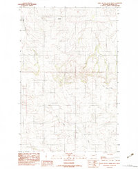
1983 Map of Three Buttes Creek West
USGS Topo · Published 1983About this map
The rolling plains of eastern Richland County are captured here in the early 1980s, revealing a landscape defined by seasonal watercourses and agricultural infrastructure. Drainages like Middle Charlie Creek and the headwaters of the East Fork Fox Creek carve deep through the terrain, while Antelope Springs provides a focal point for water in this arid stretch of Montana. The map highlights the isolation of the high plains, where the most significant landmarks are often functional structures such as the numerous Grain Bins and a Gravel Pit located near the southern boundary. This provisional survey is particularly useful for understanding the network of unimproved roads and trails that linked these remote ranching sites before modern development altered the local topography near Three Buttes Creek.
Find a feature on this map
7 named features on this map. Tap any name to fly to it.
Don’t see what you’re looking for? This feature index may not catch every label — zoom into the map to look around manually.
Map Details
Editions of this 1983 Three Buttes Creek West Map
This is the sole edition of this map. No revisions or reprints were ever made.
Other maps of this area

1909 · Glendive
USGS Topo · 1:250,000

1954 · Glendive
USGS Topo · 1:250,000

1957 · Glendive
USGS Topo · 1:250,000

1958 · Glendive
USGS Topo · 1:250,000

1972 · Fox Lake
USGS Topo · 1:24,000

1972 · Lambert
USGS Topo · 1:24,000

1972 · Enid
USGS Topo · 1:24,000

1981 · Sidney
USGS Topo · 1:100,000
1983 · Elmdale
USGS Topo · 1:24,000
1983 · Carda Coulee
USGS Topo · 1:24,000