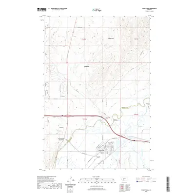
2020 Map of Three Forks
USGS Topo · Published 2020About this map
The confluence of the Madison River and the Jefferson River defines this Gallatin County landscape, marking the headwaters region as it appeared in the early 21st century. The city of Three Forks serves as the primary hub, showing a grid of residential streets south of the major Interstate 90 corridor. North of the highway, the terrain rises into the rolling hills of the Copper City and Wheatland areas, where a network of modern residential loops like Horizon Loop and Aurora Loop meet older thoroughfares such as Old Town Rd.
Find a feature on this map
67 named features on this map. Tap any name to fly to it.
Don’t see what you’re looking for? This feature index may not catch every label — zoom into the map to look around manually.
Map Details
Editions of this 2020 Three Forks Map
This is the sole edition of this map. No revisions or reprints were ever made.
Other maps of this area

1886 · Fort Logan
USGS Topo · 1:250,000

1888 · Three Forks
USGS Topo · 1:250,000

1894 · Three Forks
USGS Topo · 1:250,000

1895 · Three Forks
USGS Topo · 1:250,000

1947 · Bozeman
USGS Topo · 1:250,000

1948 · Bozeman
USGS Topo · 1:250,000

1948 · White Sulphur Springs
USGS Topo · 1:250,000

1949 · Radersburg
USGS Topo · 1:62,500

1949 · Manhattan
USGS Topo · 1:62,500

1949 · Toston
USGS Topo · 1:62,500
Featured Places
- Three Forks, MT
- Murphys Trailer Court, Three Forks
- Copper City, MT
- Three Forks Junction, MT
- Gallatin County, MT