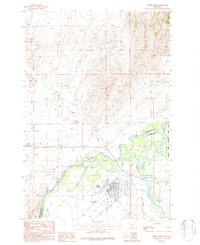
1987 Map of Three Forks
USGS Topo · Published 1987About this map
Three Forks sits at the vital hydrological nexus where the Jefferson River, Madison River, and Missouri River converge. This 1980s-era Montana landscape reflects a complex arrangement of water-driven geography and industrial infrastructure. The town itself is defined by its agricultural and transit heritage, evidenced by the presence of a Grain Elevator, Storage Bins, and a substantial Feed Lot near the rail lines.
Find a feature on this map
17 named features on this map. Tap any name to fly to it.
Don’t see what you’re looking for? This feature index may not catch every label — zoom into the map to look around manually.
Map Details
Editions of this 1987 Three Forks Map
This is the sole edition of this map. No revisions or reprints were ever made.
Other maps of this area

1886 · Fort Logan
USGS Topo · 1:250,000

1888 · Three Forks
USGS Topo · 1:250,000

1894 · Three Forks
USGS Topo · 1:250,000

1895 · Three Forks
USGS Topo · 1:250,000

1947 · Bozeman
USGS Topo · 1:250,000

1948 · Bozeman
USGS Topo · 1:250,000

1948 · White Sulphur Springs
USGS Topo · 1:250,000

1949 · Radersburg
USGS Topo · 1:62,500

1949 · Manhattan
USGS Topo · 1:62,500

1949 · Toston
USGS Topo · 1:62,500
Featured Places
- Three Forks, MT
- Three Forks Junction, MT
- Copper City, MT
- Murphys Trailer Court, Three Forks
- Gallatin County, MT