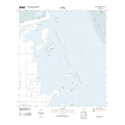
2010 Map of Three Islands
USGS Topo · Published 2010About this map
Laguna Madre dominates this coastal landscape, where a chain of islets and points defines the interface between the mainland and the bay. The map illustrates the complex hydrography of the region, including the Arroyo Colorado Cutoff and the Intracoastal Waterway channel that cuts through the shallow waters. Notable terrain features like Horse Island, Rattlesnake Island, and the group known as Three Islands—comprising Medio Island, Primero Island, and Ultimo Island—serve as key landmarks for maritime navigation and local history. To the south, the El Realito Peninsula and Rincon de Guajardo frame El Realito Bay, while the Rancho Buena Vista Airport and Buena Vista Blvd indicate the modern infrastructure serving this stretch of the Texas Gulf Coast.
Find a feature on this map
29 named features on this map. Tap any name to fly to it.
Don’t see what you’re looking for? This feature index may not catch every label — zoom into the map to look around manually.
Map Details
Editions of this 2010 Three Islands Map
This is the sole edition of this map. No revisions or reprints were ever made.
Other maps of this area

1929 · La Coma
USGS Topo · 1:24,000

1929 · Buena Vista
USGS Topo · 1:24,000

1930 · Padre Island No. 1
USGS Topo · 1:24,000

1930 · La Leona
USGS Topo · 1:24,000

1930 · Padre Island No. 2
USGS Topo · 1:24,000

1930 · Laguna Atascosa
USGS Topo · 1:24,000

1934 · La Coma
USGS Topo · 1:31,680

1935 · Padre Island No 1
USGS Topo · 1:31,680

1935 · Padre Island NO. 2
USGS Topo · 1:31,680

1935 · Buena Vista
USGS Topo · 1:31,680