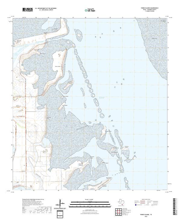
2022 Map of Three Islands
USGS Topo · Published 2022About this map
Laguna Atascosa defines the western edge of this coastal reach, where the South Texas brush meets the marshy transitions of the Lower Rio Grande Valley. The landscape is a network of peninsulas and small islands, including Rincon de Guajardo and El Realito Peninsula, separated by the shallow waters of El Realito Bay. The mapping of Buena Vista Blvd and the Rancho Buena Vista Airport indicates the modern infrastructure supporting the area's light settlement at Rincon Buena Vista.
Find a feature on this map
37 named features on this map. Tap any name to fly to it.
Don’t see what you’re looking for? This feature index may not catch every label — zoom into the map to look around manually.
Map Details
Editions of this 2022 Three Islands Map
This is the sole edition of this map. No revisions or reprints were ever made.
Other maps of this area

1929 · La Coma
USGS Topo · 1:24,000

1929 · Buena Vista
USGS Topo · 1:24,000

1930 · Padre Island No. 1
USGS Topo · 1:24,000

1930 · La Leona
USGS Topo · 1:24,000

1930 · Padre Island No. 2
USGS Topo · 1:24,000

1930 · Laguna Atascosa
USGS Topo · 1:24,000

1934 · La Coma
USGS Topo · 1:31,680

1935 · Padre Island No 1
USGS Topo · 1:31,680

1935 · Padre Island NO. 2
USGS Topo · 1:31,680

1935 · Buena Vista
USGS Topo · 1:31,680