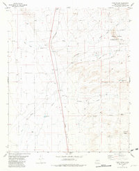
1981 Map of Three Rivers
USGS Topo · Published 1982About this map
Three Rivers is the focal point of this arid New Mexico landscape, situated where the Southern Pacific railroad cuts through the valley floor. The map highlights a significant Petroglyph Site near a dedicated Picnic Area, indicating a region with deep archaeological importance. Water management is the primary theme of human activity here, evidenced by a network of drainage features like New Draw and Sand Draw, alongside vital water sources such as the Crosby Well (Flowing) and Aguilar Spring. To the west, the boundary of the White Sands Missile Range marks a stark division between civilian ranching or transit lands and restricted military territory. Small-scale infrastructure, including a Landing Strip and the Chosa Tank, underscores the specialized adaptations required for life and travel in this high-desert environment.
Find a feature on this map
23 named features on this map. Tap any name to fly to it.
Don’t see what you’re looking for? This feature index may not catch every label — zoom into the map to look around manually.
Map Details
Editions of this 1981 Three Rivers Map
This is the sole edition of this map. No revisions or reprints were ever made.
Other maps of this area

1916 · Tularosa
USGS Topo · 1:125,000

1947 · Three Rivers
USGS Topo · 1:62,500

1948 · Tularosa
USGS Topo · 1:62,500

1950 · Three Rivers
USGS Topo · 1:24,000

1950 · Oscura
USGS Topo · 1:24,000

1950 · Sierra Blanca Peak
USGS Topo · 1:62,500

1950 · Mescalero
USGS Topo · 1:62,500

1954 · Tularosa
USGS Topo · 1:250,000

1955 · Roswell
USGS Topo · 1:250,000

1958 · Roswell
USGS Topo · 1:250,000