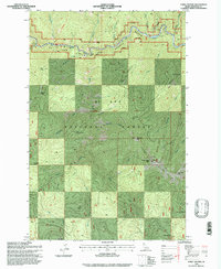
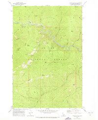
1995 Map of Three Sisters
USGS Topo · Published 1997About this map
The St Joe River winds through the northern portion of this Idaho panhandle landscape, designated here as the St Joe Wild and Scenic River. The terrain is defined by the prominent Three Sisters peaks—consisting of Little Sister Peak, West Sister Peak, and Middle Sister Peak—which anchor the central and eastern ridges of the St Joe National Forest. A high-altitude Middle Sister Lookout stands as a focal point for forest management and fire detection, overlooking the complex drainage systems of Bear Skull Creek and Sisters Creek.
Find a feature on this map
88 named features on this map. Tap any name to fly to it.
Don’t see what you’re looking for? This feature index may not catch every label — zoom into the map to look around manually.
Map Details
Editions of this 1995 Three Sisters Map
This is the sole edition of this map. No revisions or reprints were ever made.
Other maps of this area

1914 · Avery
USGS Topo · 1:125,000

1917 · Avery
USGS Topo · 1:125,000

1956 · Saltese
USGS Topo · 1:62,500

1956 · Wallace
USGS Topo · 1:250,000

1957 · Wallace
USGS Topo · 1:62,500

1960 · Wallace
USGS Topo · 1:250,000
1969 · Bathtub Mtn
USGS Topo · 1:24,000
1969 · Montana Peak
USGS Topo · 1:24,000
1969 · Monumental Buttes
USGS Topo · 1:24,000
1969 · Thor Mountain
USGS Topo · 1:24,000