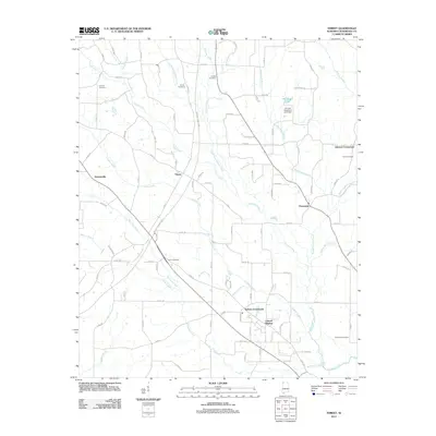
2011 Map of Threet
USGS Topo · Published 2011About this map
Stewartville and the central settlement of Threet anchor this corner of Lauderdale County, where a dense network of county roads connects rural communities and agricultural lands. The landscape is defined by the drainage systems of the North Fork Cypress Creek and Lindsey Creek, which feed into the larger Cypress Creek waterway. These creek valleys are marked by several family-named landmarks and historical sites, including Pine Hill Cemetery, Lindsey Cemetery, and the Dowdy Cemetery, providing significant reference points for local genealogy.
Find a feature on this map
85 named features on this map. Tap any name to fly to it.
Don’t see what you’re looking for? This feature index may not catch every label — zoom into the map to look around manually.
Map Details
Editions of this 2011 Threet Map
This is the sole edition of this map. No revisions or reprints were ever made.
Other maps of this area

1905 · Waynesboro
USGS Topo · 1:125,000

1914 · Muscle Shoals
USGS Topo · 1:48,000

1916 · Muscle Shoals
USGS Topo · 1:62,500

1924 · Gravelly Springs
USGS Topo · 1:48,000

1926 · Gravelly Springs
USGS Topo · 1:62,500

1935 · Cherokee
USGS Topo · 1:24,000

1935 · Wright
USGS Topo · 1:24,000

1936 · Light
USGS Topo · 1:24,000

1936 · Threet
USGS Topo · 1:24,000

1936 · Cypress Inn
USGS Topo · 1:24,000