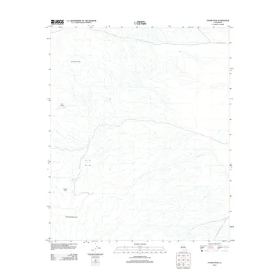
2012 Map of Thumb Peak
USGS Topo · Published 2012About this map
Thumb Peak rises as a central landmark in this desert region of Imperial County, situated between the Mule Mountains to the north and the Palo Verde Mountains to the south. The landscape is defined by vast alluvial fan systems and arid drainage patterns typical of the Colorado Desert. Historic transportation routes cross this terrain, most notably The Bradshaw Trl, a legendary 19th-century gold rush trail that connected the Colorado River to coastal California. Evidence of the region's sparse water resources is found at Clapp Spring, a vital point for travelers navigating between Coon Hollow and the Old Palo Verde Rd. This 2012 survey provides a clear view of the natural relief and established desert tracks that have dictated movement through this corner of California for generations.
Find a feature on this map
7 named features on this map. Tap any name to fly to it.
Don’t see what you’re looking for? This feature index may not catch every label — zoom into the map to look around manually.
Map Details
Editions of this 2012 Thumb Peak Map
This is the sole edition of this map. No revisions or reprints were ever made.
Other maps of this area

1942 · Blythe
USGS Topo · 1:250,000

1945 · Cibola
USGS Topo · 1:62,500

1951 · Cibola
USGS Topo · 1:62,500

1952 · Mc Coy Spring
USGS Topo · 1:62,500

1952 · Palo Verde
USGS Topo · 1:24,000

1952 · Ripley
USGS Topo · 1:24,000

1953 · Palo Verde Mountains
USGS Topo · 1:62,500

1954 · Salton Sea
USGS Topo · 1:250,000

1955 · Salton Sea
USGS Topo · 1:250,000
1955 · Cibola
USGS Topo · 1:24,000