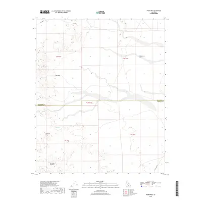
2018 Map of Thumb Peak
USGS Topo · Published 2018About this map
The arid borderlands between Riverside and Imperial Counties are defined here by a series of prominent landforms and historic travel routes. The Mule Mountains dominate the northwestern portion of the map, giving way to the low-lying expanse of Coon Hollow and the Palo Verde Mesa. Further south, the Palo Verde Mountains rise towards the distinctive Thumb Peak, a landmark of the desert interior.
Find a feature on this map
14 named features on this map. Tap any name to fly to it.
Don’t see what you’re looking for? This feature index may not catch every label — zoom into the map to look around manually.
Map Details
Editions of this 2018 Thumb Peak Map
This is the sole edition of this map. No revisions or reprints were ever made.
Other maps of this area

1942 · Blythe
USGS Topo · 1:250,000

1945 · Cibola
USGS Topo · 1:62,500

1951 · Cibola
USGS Topo · 1:62,500

1952 · Mc Coy Spring
USGS Topo · 1:62,500

1952 · Palo Verde
USGS Topo · 1:24,000

1952 · Ripley
USGS Topo · 1:24,000

1953 · Palo Verde Mountains
USGS Topo · 1:62,500

1954 · Salton Sea
USGS Topo · 1:250,000

1955 · Salton Sea
USGS Topo · 1:250,000
1955 · Cibola
USGS Topo · 1:24,000