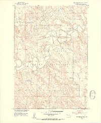
1951 Map of Thunder Butte
USGS Topo · Published 1953About this map
The Cheyenne River Indian Reservation landscape is defined by the winding course of the Moreau River as it cuts through the plains of Ziebach County. Surveyed in the early 1950s, this area centers on the prominent landmark of Thunder Butte, which rises above the surrounding drainages. The river's path is marked by numerous fords, indicating the essential crossing points for local travel before modern infrastructure became widespread.
Find a feature on this map
9 named features on this map. Tap any name to fly to it.
Don’t see what you’re looking for? This feature index may not catch every label — zoom into the map to look around manually.
Map Details
Editions of this 1951 Thunder Butte Map
2 editions found
Other maps of this area

1951 · Redelm NE
USGS Topo · 1:24,000

1951 · Dupree NE
USGS Topo · 1:24,000

1951 · Thunder Butte
USGS Topo · 1:24,000

1953 · McIntosh
USGS Topo · 1:250,000

1958 · McIntosh
USGS Topo · 1:250,000

1979 · Dupree
USGS Topo · 1:25,000

1982 · Irish Creek SW
USGS Topo · 1:24,000
1982 · Red Elm
USGS Topo · 1:24,000

1982 · Glad Valley SE
USGS Topo · 1:24,000
1982 · Irish Creek SE
USGS Topo · 1:24,000