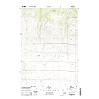
2017 Map of Thunder Gulch
USGS Topo · Published 2017About this map
Lava Creek descends through the high, arid landscape of Clark County within the southeastern reaches of the Targhee National Forest. This modern 2017 survey details the complex topography of the high desert and mountain transition, where seasonal watercourses like Lava Creek define the drainage patterns across the volcanic terrain. The map provides a precise look at the land division and section lines of the Public Land Survey System, illustrating how federal management and private holdings intersect in this corner of Idaho. It is an essential document for understanding contemporary land use and the enduring geographic character of the region as it is managed today by the U.S. Geological Survey.
Find a feature on this map
2 named features on this map. Tap any name to fly to it.
Don’t see what you’re looking for? This feature index may not catch every label — zoom into the map to look around manually.
Map Details
Editions of this 2017 Thunder Gulch Map
This is the sole edition of this map. No revisions or reprints were ever made.
Other maps of this area

1955 · Dubois
USGS Topo · 1:250,000

1957 · Paul Reservoir
USGS Topo · 1:62,500

1958 · Dubois
USGS Topo · 1:250,000

1964 · Dubois NW
USGS Topo · 1:24,000

1964 · Lone Butte
USGS Topo · 1:24,000

1964 · Small
USGS Topo · 1:24,000

1972 · Spencer South
USGS Topo · 1:24,000

1972 · Spencer North
USGS Topo · 1:24,000

1983 · Dubois
USGS Topo · 1:100,000
1987 · Thunder Gulch
USGS Topo · 1:24,000