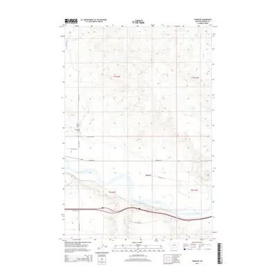
2014 Map of Thurlow
USGS Topo · Published 2014About this map
The Yellowstone River cuts through this Rosebud County landscape, anchoring the small settlement of Thurlow. By the early 21st century, the transportation network reveals a layering of history, with Old Highway 10 and Highway 446 paralleling the river's course. North of the water, the terrain rises toward Jack Creek Hill, where a network of rural routes like Sand Creek Rd and Thurlow Rd navigate the drainage basins of intermittent streams. The map clearly documents the crossing at Sand Creek Bridge, a vital point in the local infrastructure. The land is defined by these seasonal waterways, including Goose Cr and Sweeney Cr, which carve through the plains and dictate the placement of ranch roads and township boundaries in this part of Montana.
Find a feature on this map
21 named features on this map. Tap any name to fly to it.
Don’t see what you’re looking for? This feature index may not catch every label — zoom into the map to look around manually.
Map Details
Editions of this 2014 Thurlow Map
This is the sole edition of this map. No revisions or reprints were ever made.
Other maps of this area

1954 · Forsyth
USGS Topo · 1:250,000

1957 · Forsyth
USGS Topo · 1:250,000

1958 · Forsyth
USGS Topo · 1:250,000

1968 · Rosebud
USGS Topo · 1:24,000

1968 · Box Canyon Coulee
USGS Topo · 1:24,000

1968 · Sand Buttes
USGS Topo · 1:24,000

1968 · Hathaway
USGS Topo · 1:24,000

1968 · Hathaway NW
USGS Topo · 1:24,000

1968 · Thurlow
USGS Topo · 1:24,000
1969 · Miller Creek NW
USGS Topo · 1:24,000