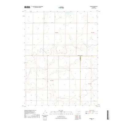
2019 Map of Thurman
USGS Topo · Published 2019About this map
The Thurman Cem serves as a lone local landmark in the northern reaches of this rural landscape, situated along Co RD 3 in Washington County. This region is defined by the winding paths of the North Fork Arikaree River and the Arikaree River, which cut across the high plains terrain. A notable geographic intersection occurs where the borders of Washington Co, Lincoln Co, and Kit Carson Co converge, marking a significant tri-county boundary point. The map reveals a strictly gridded system of local roads, such as Co RD 0 and Co RD CC, which navigate the subtle elevation changes of the river valleys. This survey illustrates the sparse, agrarian nature of the Eastern Plains in the early twenty-first century, preserving the placement of isolated cemeteries and the natural hydrography that historically dictated land use in this open territory.
Find a feature on this map
23 named features on this map. Tap any name to fly to it.
Don’t see what you’re looking for? This feature index may not catch every label — zoom into the map to look around manually.
Map Details
Editions of this 2019 Thurman Map
This is the sole edition of this map. No revisions or reprints were ever made.
Other maps of this area

1954 · Limon
USGS Topo · 1:250,000

1957 · Limon
USGS Topo · 1:250,000

1958 · Limon
USGS Topo · 1:250,000

1973 · Lindon NE
USGS Topo · 1:24,000

1973 · Shaw
USGS Topo · 1:24,000

1977 · Thurman
USGS Topo · 1:24,000

1977 · Arickaree
USGS Topo · 1:24,000

1977 · Anton SE
USGS Topo · 1:24,000
1978 · Anton
USGS Topo · 1:24,000

1979 · Flagler NW
USGS Topo · 1:24,000