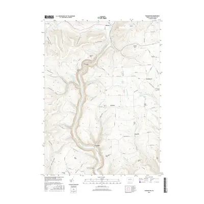
2016 Map of Tiadaghton
USGS Topo · Published 2016About this map
Ansonia and the surrounding highlands of Tioga County are defined by the deep incision of the Pine Creek Gorge, a major topographical feature that dominates the western half of this survey. The settlement of Tiadaghton sits at a narrow point in the gorge, while Colton Point offers a overlook of the valley where Pine Creek is joined by numerous steep tributaries like Owassee Slide Run and Bear Run. This landscape is a mix of high-plateau agriculture and timbered hollows, with rural life centered on small hamlets like Kennedy and Olmsville.
Find a feature on this map
99 named features on this map. Tap any name to fly to it.
Don’t see what you’re looking for? This feature index may not catch every label — zoom into the map to look around manually.
Map Details
Editions of this 2016 Tiadaghton Map
This is the sole edition of this map. No revisions or reprints were ever made.
Other maps of this area

1899 · Gaines
USGS Topo · 1:62,500

1900 · Gaines
USGS Topo · 1:62,500

1900 · Elkland
USGS Topo · 1:62,500

1946 · Tiadaghton
USGS Topo · 1:24,000

1946 · Antrim
USGS Topo · 1:62,500

1946 · Cedar Run
USGS Topo · 1:24,000

1946 · Antrim
USGS Topo · 1:24,000

1946 · Morris
USGS Topo · 1:24,000

1947 · Galeton
USGS Topo · 1:62,500

1947 · Lee Fire Tower
USGS Topo · 1:24,000
Featured Places
- Morris Township, PA
- Gaines Township, PA
- Elk Township, PA
- Thumptown, Delmar Township
- Owassee, Shippen Township