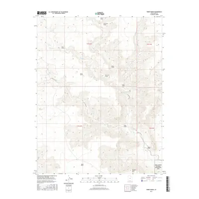
2017 Map of Tibbet Bench
USGS Topo · Published 2017About this map
Tibbet Bench and the surrounding high plateaus define this corner of Kane County, where the desert landscape is carved by an intricate network of drainages and canyons. The map details the transition from the flat-topped mesas like Nipple Bench to the deep incisions of Tibbet Canyon and John Henry Canyon. These geological features shaped the early routes through the region, including Tippetts Canyon Rd and Smokey Hollow Rd, which navigate the elevation changes between the benches and the lower basins.
Find a feature on this map
24 named features on this map. Tap any name to fly to it.
Don’t see what you’re looking for? This feature index may not catch every label — zoom into the map to look around manually.
Map Details
Editions of this 2017 Tibbet Bench Map
This is the sole edition of this map. No revisions or reprints were ever made.
Other maps of this area

1886 · Escalante
USGS Topo · 1:250,000

1922 · Warm Creek
USGS Topo · 1:63,360

1922 · Upper Last Chance
USGS Topo · 1:63,360

1922 · Rees Canyon
USGS Topo · 1:63,360

1953 · Nipple Butte
USGS Topo · 1:62,500

1953 · Gunsight Butte
USGS Topo · 1:62,500

1956 · Escalante
USGS Topo · 1:250,000

1960 · Escalante
USGS Topo · 1:250,000

1968 · Fourmile Bench
USGS Topo · 1:24,000
1968 · Ship Mountain Point
USGS Topo · 1:24,000