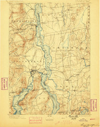
1896 Map of Ticonderoga
USGS Topo · Published 1898About this map
Fort Ticonderoga and the nearby Ticonderoga Ruin dominate the strategic narrows of Lake Champlain in this late nineteenth-century survey. The landscape is a corridor of military history and early industrial transit, where the Central Vermont R. R. meets the Delaware and Hudson Canal Co. R. R. at Addison Junction. High ground like Mt. Defiance and Mt. Independence overlooks the water, while the eastern shore is dotted with agricultural and lake-side settlements such as Shoreham, Bridport, and Larrabees Point. Further south, the map captures the northern reach of Lake George, featuring landmarks like Rogers Slide and Anthonys Nose. The survey reveals a region transitioning from its storied colonial defenses into a hub of rail commerce and local industry, evident in the detailed placement of schools, mills, and landings along the Route of Steamers.
Find a feature on this map
102 named features on this map. Tap any name to fly to it.
Don’t see what you’re looking for? This feature index may not catch every label — zoom into the map to look around manually.
Map Details
Editions of this 1896 Ticonderoga Map
2 editions found
Other maps of this area

1893 · Whitehall
USGS Topo · 1:62,500

1894 · Elizabethtown
USGS Topo · 1:62,500

1894 · Port Henry
USGS Topo · 1:62,500

1894 · Ticonderoga
USGS Topo · 1:62,500

1895 · Whitehall
USGS Topo · 1:62,500

1895 · Elizabethtown
USGS Topo · 1:62,500

1895 · Paradox Lake
USGS Topo · 1:62,500

1895 · Castleton
USGS Topo · 1:62,500

1896 · Ticonderoga
USGS Topo · 1:62,500

1897 · Bolton
USGS Topo · 1:62,500