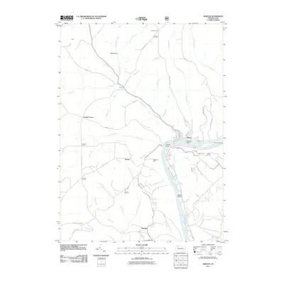
2011 Map of Tidioute
USGS Topo · Published 2011About this map
Tidioute serves as the focal point of this riverfront landscape, situated where several creeks join the Allegheny River. The terrain is defined by dramatic elevation changes rising from the riverbank, notably at Economite Hill and Babylon Hill. A series of islands, including McGuire Island, Tidioute Island, and Siggias Island, divide the river's flow through the center of the sheet. Local genealogy and land use patterns are anchored by rural settlements such as Triumph, Fagundus, and Whitehead Corners. Historical markers of settlement include the Morrison Cemetery and Gorman Cemetery, alongside family-named landmarks like the Tidioute Overlook. The road network, featuring Youngsville Rd and McCalley Hill Rd, connects these upland communities to the river valley, illustrating the transition from traditional river-based commerce to modern rural infrastructure.
Find a feature on this map
61 named features on this map. Tap any name to fly to it.
Don’t see what you’re looking for? This feature index may not catch every label — zoom into the map to look around manually.
Map Details
Editions of this 2011 Tidioute Map
This is the sole edition of this map. No revisions or reprints were ever made.
Other maps of this area

1926 · Youngsville
USGS Topo · 1:62,500

1927 · Tidioute
USGS Topo · 1:48,000

1927 · Titusville
USGS Topo · 1:62,500

1929 · Corry
USGS Topo · 1:48,000

1929 · Youngsville
USGS Topo · 1:62,500

1930 · Tidioute
USGS Topo · 1:62,500

1932 · Corry
USGS Topo · 1:62,500

1933 · Titusville
USGS Topo · 1:62,500

1943 · Youngsville
USGS Topo · 1:62,500

1957 · Warren
USGS Topo · 1:250,000