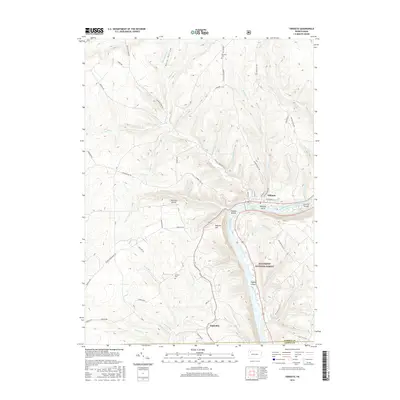
2016 Map of Tidioute
USGS Topo · Published 2016About this map
The Allegheny River defines this portion of the Pennsylvania landscape as it curves past the borough of Tidioute. This 2016 survey illustrates the river's significant influence on local geography, featuring several named islands such as Tidioute Island, McGuire Island, and Siggias Island. To the south, the settlement of Fagundus sits near the border of the Allegheny National Forest, reflecting the region's deep ties to timber and natural resource management.
Find a feature on this map
60 named features on this map. Tap any name to fly to it.
Don’t see what you’re looking for? This feature index may not catch every label — zoom into the map to look around manually.
Map Details
Editions of this 2016 Tidioute Map
This is the sole edition of this map. No revisions or reprints were ever made.
Other maps of this area

1926 · Youngsville
USGS Topo · 1:62,500

1927 · Tidioute
USGS Topo · 1:48,000

1927 · Titusville
USGS Topo · 1:62,500

1929 · Corry
USGS Topo · 1:48,000

1929 · Youngsville
USGS Topo · 1:62,500

1930 · Tidioute
USGS Topo · 1:62,500

1932 · Corry
USGS Topo · 1:62,500

1933 · Titusville
USGS Topo · 1:62,500

1943 · Youngsville
USGS Topo · 1:62,500

1957 · Warren
USGS Topo · 1:250,000