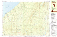
1980 Map of Tiebel Creek
USGS Topo · Published 1981About this map
Presque Isle and the wild coastline of Lake Superior anchor this survey of the western Upper Peninsula. The landscape is defined by the steep descent of the Presque Isle River, which cascades through a series of significant drops including Manabezho Falls, Manido Falls, and Nawadaha Falls before reaching the lake. Much of the northern half of the sheet is protected within the Porcupine Mountains Wilderness State Park, where high points like Summit Peak and Porcupine Peak rise above a network of drainages such as Tiebel Creek and Little Carp River.
Find a feature on this map
57 named features on this map. Tap any name to fly to it.
Don’t see what you’re looking for? This feature index may not catch every label — zoom into the map to look around manually.
Map Details
Editions of this 1980 Tiebel Creek Map
2 editions found
Other maps of this area

1953 · Ashland
USGS Topo · 1:250,000

1956 · Carp River
USGS Topo · 1:62,500

1956 · North Ironwood
USGS Topo · 1:62,500

1956 · Bergland
USGS Topo · 1:62,500

1956 · Thomaston
USGS Topo · 1:62,500

1956 · White Pine
USGS Topo · 1:62,500

1958 · Ashland
USGS Topo · 1:250,000

1958 · Iron River
USGS Topo · 1:250,000

1960 · Iron River
USGS Topo · 1:250,000

1961 · Iron River
USGS Topo · 1:250,000
Featured Places
- Ironwood Township, MI
- Wakefield Township, MI
- Carp Lake Township, MI
- Gogebic County, MI
- Ontonagon County, MI