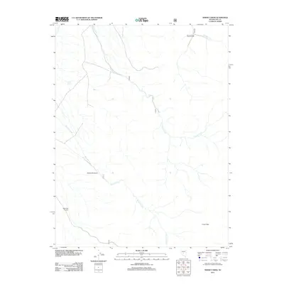
2012 Map of Tierney Creek
USGS Topo · Published 2012About this map
Marysville Canyon and New York Canyon define the high-altitude topography of this corner of Nye County, where steep drainage systems carve into the high desert landscape. The presence of the San Juan Forest Service Facility at the northern edge near San Juan Creek highlights the active land management role of the U.S. Forest Service in this region. Water sources are critical but sparse, marked by the namesake Tierney Creek and the isolated Coyote Spring. To the southeast, the terrain culminates at French Peak, while Marysville Creek winds through the southwestern section of the quadrangle. This 2012 survey illustrates the network of forest roads and trails used for resource management and backcountry access in Nevada's interior ranges.
Find a feature on this map
8 named features on this map. Tap any name to fly to it.
Don’t see what you’re looking for? This feature index may not catch every label — zoom into the map to look around manually.
Map Details
Editions of this 2012 Tierney Creek Map
This is the sole edition of this map. No revisions or reprints were ever made.
Other maps of this area

1907 · Tonopah
USGS Topo · 1:250,000

1908 · Tonopah
USGS Topo · 1:250,000

1955 · Millett
USGS Topo · 1:250,000
1956 · North Shoshone Peak
USGS Topo · 1:62,500
1956 · Millett Ranch
USGS Topo · 1:62,500

1956 · Tonopah
USGS Topo · 1:250,000

1959 · Tonopah
USGS Topo · 1:250,000

1959 · Millett
USGS Topo · 1:250,000

1962 · Tonopah
USGS Topo · 1:250,000
1971 · Carvers NW
USGS Topo · 1:24,000