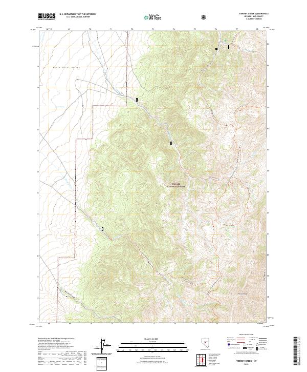
2021 Map of Tierney Creek
USGS Topo · Published 2021About this map
Toiyabe National Forest dominates this high-altitude landscape in Nye County, where the sharp relief of the Toiyabe Range transitions into the broad Reese River Valley. The mapping reveals a complex network of traditional trails and watercourses that have historically dictated movement through this arid region. The Toiyabe Crest National Recreation Trl follows the spine of the mountains, intersecting with drainage-based routes like the Marysville Canyon Trl and Tierney Creek Trl. These canyons, including New York Canyon and Park Canyon, provide the primary breaks in the steep terrain near French Peak. The presence of Coyote Spring and several named creeks such as Tierney Cr and San Juan Cr highlights the critical, scattered water sources necessary for ranching and travel in this part of central Nevada.
Find a feature on this map
23 named features on this map. Tap any name to fly to it.
Don’t see what you’re looking for? This feature index may not catch every label — zoom into the map to look around manually.
Map Details
Editions of this 2021 Tierney Creek Map
This is the sole edition of this map. No revisions or reprints were ever made.
Other maps of this area

1907 · Tonopah
USGS Topo · 1:250,000

1908 · Tonopah
USGS Topo · 1:250,000

1955 · Millett
USGS Topo · 1:250,000

1956 · North Shoshone Peak
USGS Topo · 1:62,500

1956 · Millett Ranch
USGS Topo · 1:62,500

1956 · Tonopah
USGS Topo · 1:250,000

1959 · Tonopah
USGS Topo · 1:250,000

1959 · Millett
USGS Topo · 1:250,000

1962 · Tonopah
USGS Topo · 1:250,000

1971 · Carvers NW
USGS Topo · 1:24,000