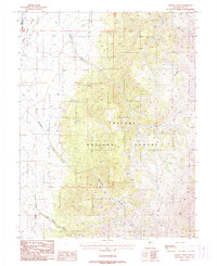
1988 Map of Tierney Creek
USGS Topo · Published 1988About this map
The Reese River Valley dominates the western edge of this 1988 landscape, marking the transition from the valley floor into the high elevations of the Toiyabe National Forest. This high-altitude terrain is defined by the sharp drainage systems of Tierney Creek, Marysville Creek, and Juan Creek, which carve deep paths through the mountain range. Portions of the Yomba Indian Reservation are visible at the northwestern corner, representing a critical cultural boundary in this part of Nye County.
Find a feature on this map
13 named features on this map. Tap any name to fly to it.
Don’t see what you’re looking for? This feature index may not catch every label — zoom into the map to look around manually.
Map Details
Editions of this 1988 Tierney Creek Map
This is the sole edition of this map. No revisions or reprints were ever made.
Other maps of this area

1907 · Tonopah
USGS Topo · 1:250,000

1908 · Tonopah
USGS Topo · 1:250,000

1955 · Millett
USGS Topo · 1:250,000

1956 · North Shoshone Peak
USGS Topo · 1:62,500

1956 · Millett Ranch
USGS Topo · 1:62,500

1956 · Tonopah
USGS Topo · 1:250,000

1959 · Tonopah
USGS Topo · 1:250,000

1959 · Millett
USGS Topo · 1:250,000

1962 · Tonopah
USGS Topo · 1:250,000

1971 · Carvers NW
USGS Topo · 1:24,000