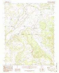
1983 Map of Tierra Amarilla
USGS Topo · Published 1983About this map
High-country agricultural patterns and irrigation networks define the Tierra Amarilla Grant in northern Rio Arriba County during the early 1980s. This survey illustrates the intricate water management system essential for high-altitude farming, featuring the Park View Ditch and numerous smaller channels drawing from the Rio Brazos and Rio Chama. The settlement pattern remains deeply rooted in traditional New Mexican communities such as Tierra Amarilla, Los Ojos, and Ensenada, where dwellings cluster along the fertile valley floors. The landscape transitions from the river valleys to the surrounding hills, marked by features like Rito de Tierra Amarilla and Willow Creek. Smaller outposts like Plaza Blanca and La Puente are visible alongside local industry, evidenced by the scattered Gravel Pit operations near the riverbanks.
Find a feature on this map
15 named features on this map. Tap any name to fly to it.
Don’t see what you’re looking for? This feature index may not catch every label — zoom into the map to look around manually.
Map Details
Editions of this 1983 Tierra Amarilla Map
2 editions found
Other maps of this area

1918 · Tusas
USGS Topo · 1:125,000

1954 · Aztec
USGS Topo · 1:250,000

1955 · Chama
USGS Topo · 1:62,500

1955 · Cebolla
USGS Topo · 1:62,500

1955 · Brazos Peak
USGS Topo · 1:62,500

1955 · Tierra Amarilla
USGS Topo · 1:62,500

1958 · Aztec
USGS Topo · 1:250,000

1962 · Aztec
USGS Topo · 1:250,000

1965 · Aztec
USGS Topo · 1:250,000

1981 · Chama
USGS Topo · 1:100,000