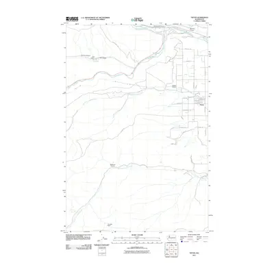
2011 Map of Tieton
USGS Topo · Published 2011About this map
Tieton serves as the primary residential hub in this corner of Yakima County, where the agricultural grid of the valley meets the rising terrain of the Cascade foothills. The landscape is defined by the convergence of the Naches River and the Tieton River, with the latter winding through several prominent topographic breaks including French Canyon and Oak Creek. The irrigation-fed agriculture of the eastern section, marked by routes like Vineyard Rd and Tieton Heights Rd, transitions sharply into the more arid, dissected uplands to the west.
Find a feature on this map
43 named features on this map. Tap any name to fly to it.
Don’t see what you’re looking for? This feature index may not catch every label — zoom into the map to look around manually.
Map Details
Editions of this 2011 Tieton Map
This is the sole edition of this map. No revisions or reprints were ever made.
Other maps of this area

1899 · Ellensburg
USGS Topo · 1:125,000

1901 · Ellensburg
USGS Topo · 1:125,000

1950 · Yakima
USGS Topo · 1:250,000

1958 · Ellensburg
USGS Topo · 1:62,500

1958 · Wiley City
USGS Topo · 1:24,000

1958 · Naches
USGS Topo · 1:24,000

1958 · Yakima
USGS Topo · 1:250,000

1961 · Yakima
USGS Topo · 1:250,000

1971 · Nile
USGS Topo · 1:24,000
1971 · Milk Canyon
USGS Topo · 1:24,000